
Озеро Титикака – это пресноводный водоем, расположенный в высокогорье Анд. Оно считается наиболее крупным в Южной Америке, привлекает внимание не только расположением, но и богатством флоры и фауны. Благодаря уникальному ландшафту и живописности местности, водоем ежегодно привлекает тысячи туристов, что поспособствовало развитию инфраструктуры и разработке большого количества экскурсионных маршрутов.
Характеристика озера Титикака
Озеро достаточно крупное, считается самым большим естественным резервуаром пресной воды в Южной Америке. Оно находится на высоте 3593 м над уровнем моря. Его площадь составляет примерно 8370 км². Ширина – 66 км, а длина – 176.
Протяженность извилистой береговой линии составляет 1125 км. Ее формирует около 40 бухт и полуостровов. Средняя глубина водоема – 107 м, а максимальная – 281.
Озеро расположено в горах, где воздух достаточно разрежен. Это в сочетании с сильными ветрами обеспечивает испарение на уровне 90–95%. Содержание соли в воде не превышает 1%.
Титикака считается малопродуктивным водоемом, т.к. в нем низкое содержание питательных веществ и кислорода.
В озеро поступает только талая и дождевая вода, поэтому оно достаточно холодное. Температура поверхностных вод в среднем составляет +10…+14°C. Это не создает условий для бурного развития водяной флоры и фауны.
Почему озеро назвали именно так
Вблизи озера до открытия континента проживало несколько племен индейцев. Народы кечуа и аймара называли этот водоем Мамакота. Кроме того, есть упоминания, что в древности озеро носило имя «Пукина».
Кроме того, было еще не менее 15 названий, которые дали этому водоему люди, жившие на его берегах. Свое окончательное наименование озеро получило, когда его обнаружили испанцы. Оно включало 2 слова «тики» и «кака». Первое переводится как «свинец» или «пума», а второе – как «серый», «горный» или «трещина».
Некоторые исследователи считают, что точный перевод названия озера «серая пума» или «горная пума».
Есть вероятность, что такое имя дали водоему из-за древнего наскального рисунка хищника, найденного на острове Исла-дель-Соль.
Кроме того, есть мнение, что название Титикака – искаженный вариант словосочетания «такси-кала», использовавшийся для обозначения священной для коренных народов горы на острове Исла-дель-Соль.
Испанцам было сложно запомнить местные названия, поэтому они использовали искаженное наименование святыни, имевшей важное религиозное значение для жителей, для обозначения озера.
Географическое положение
Географически озеро находится в северной части Южной Америки. Его координаты расположения на материке: 15°49’30″ю.ш. 69°19’30″з.д.
Две составляющие озера
Этот водоем включает 2 почти изолированных бассейна, соединенных проливом Тикуина, ширина которого в самом узком месте не превышает 800 м. Самая крупная часть – Лаго-Гранде – имеет среднюю глубину около 135 м. Меньшая составляющая получила название Лого-Пекеньо. Она мелководная, поэтому лучше прогревается.
Расположение озера Титикака на карте Южной Америки
Озеро находится между 2 хребтами Анд. Оно расположено в северной части эндорейской котловины Альтиплано на границе Боливии и Перу. Таким образом, озеро принадлежит сразу 2 странам. При этом большая часть водоема в перуанской юрисдикции. Ближайший крупный город – Пуно – важный туристический центр.
Боливии принадлежит меньшая часть озера. Она интенсивнее заселена. Здесь находится главный туристический центр этой части Боливии – Ла-Пас. На северо-восточном берегу водоема расположена Кордильера-Реаль – гора, которая считается самым высоким пиком Анд. В боливийской части озера его глубина резко увеличивается.
.jpg)
Экологическая ситуация
Экологическая ситуация в зоне озера ухудшается с каждым годом. Уже длительное время отмечается уменьшение объема воды в его бассейне. Это связано со снижением уровня осадков и таянием ледников.
Ухудшает экологическую ситуацию и стремительная урбанизация побережья.
Проблема заключается не только в росте численности населения, но и в большом количестве туристов, которые ежегодно посещают эту местность. В воду попадает все больше канализационных стоков, а также твердый мусор.
Ситуацию усугубляет медленный сток, из-за чего загрязнения накапливаются в бассейне озера. Разложение в нем большого количества промышленных и канализационных стоков приводит к образованию большого объема метана.
Это в сочетании с накоплением тяжелых металлов и других вредных соединений негативно влияет на местную флору и фауну. Многие виды, обитающие в водах озера и его прибрежных зонах, находятся на грани вымирания.
Климат на территории озера
Для территории, где располагается озеро, характерен высокогорный субтропический климат. На протяжении года сохраняются невысокие температуры, варьирующиеся от -7,5 до +18,8°C.
При этом количество осадков не превышает 610 мм в год. Большая часть из них выпадает во время летних дождей. Зимы достаточно сухие, с холодными ночами и достаточно теплыми днями.
Крупные реки, которые впадают в озеро
Река Рамис считается самой крупной артерией, питающей озеро. Она впадает в Титикака с северо-западной стороны. Через нее поступает не мене 2/5 всего объема воды, наполняющей бассейн озера.
Эту артерию питают только высокогорные ледники, поэтому она достаточно холодная. Кроме того, в озеро впадают еще 4 относительно крупные реки, не пересыхающие на протяжении года.
К ним относятся:
- Сушез.
- Уанкане.
- Илаве.
- Коата.
Остальные водные артерии более мелкие и представляют собой неглубокие ручьи, которые пересыхают зимой, когда ледники подмерзают. Единственным стоком озера считается Рио Десагуадеро. Таким путем теряется до 10% воды. Остальные 90% испаряются за счет испарения, вызванного сильными ветрами.
Достопримечательности на территории Титикака
Вблизи озера зарождалось и развивалось много древних цивилизаций коренных народов, поэтому в прибрежной зоне, а также на островах осталось немало исторических памятников. Некоторые объекты считаются особенно ценными и охраняемыми.
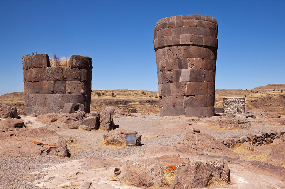
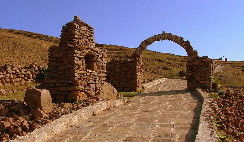
Погребальные башни Сильустани
Погребальные башни Сильустани – это древнее кладбище, которое находится около города Пуно. Считается, что оно было создано еще до построения цивилизации инков.
Его относят к периоду существования империи Колья, созданной народностью аймара. Это государственное образование было завоевано инками примерно в XV в.
На территории древнего кладбища есть большое количество башен, использовавшихся в качестве семейных гробниц. Многие захоронения были серьезно повреждены «черными копателями», которые для получения доступа к возможным сокровищам взрывали эти сооружения динамитом. Кроме того, на кладбищах есть ряд недостроенных башен.
Культуре аймара было свойственно особое почитание культа предков и связи существующего поколения с предыдущим. Проведенные исследования показали, что внутри башня имеет форму матки.
Мертвого человека мумифицировали и только после этого укладывали в гробницу в позе эмбриона. Считалось, что это способствовало возрождению человека в загробном мире.
На руинах гробниц часто выявляют выгравированные рисунки ящериц. В культуре аймара эти животные являются символом возрождающейся жизни, т.к. способны отращивать потерянный хвост. Архитектура гробниц достаточно сложна. Аймары использовали обработанные камни, имеющие прямоугольную форму.
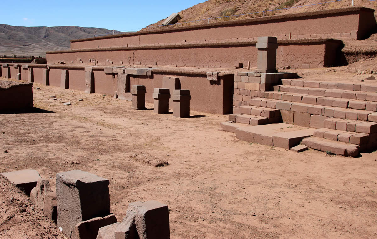
Пирамида Акапана
Пирамида Акапана находится вблизи озера Титикака на территории Боливии и считается главной достопримечательностью этой страны. Комплекс сохранился относительно неплохо.
Он представляет собой курган, достигающий в высшей точке 15 м. Основание – около 200 м. Строение имеет 3-ступенчатую форму. Ее широкая сторона обращена на восток, а узкая – на запад. Пирамида была возведена еще до открытия материка Колумбом.
Строение выполнено из земли, внешне облицовано тяжелыми плитами.
Только 10% этих камней сохранились до современности. Исследование этой пирамиды позволило выявить внутри нее сеть зигзаговидных каналов, тщательно состыкованных между собой. Их использовали для подачи воды вниз из бассейна наверху.
Точное назначение этой пирамиды неизвестно. Есть предположение, что здесь проводились религиозные ритуалы, делались жертвоприношения богам. Сейчас выполняются работы по реставрации пирамиды Акапана.
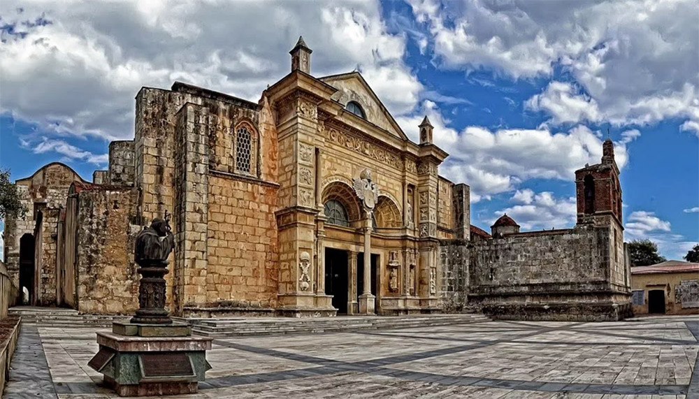
Храм Санто-Доминго
Храм Санто-Доминго был возведен испанцами при освоении ими этой территории. Расположен он возле города Пуно. Комплекс построек сохранился достаточно плохо, но даже руины являются достаточно посещаемым туристами местом.
Острова на воде и племя уросов
В озере есть 41 остров. Большинство из них достаточно мелкие и необитаемые. Наиболее крупные острова плотно заселены. Самый обжитой из них называется Амантани. Он имеет округлую форму и площадь около 15 км².
Его населяют люди, которые говорят на языке кечуа. Здесь живут около 4 тыс. человек. На острове находятся 2 горных пика – Пачатата и Пачамама. На обеих вершинах есть древние руины.
Склоны террасированы и используются для выращивания сельскохозяйственных культур. На этом острове запрещено использование машин. Здесь нет отелей. Инфраструктура развита слабо. Туристы останавливаются у местных жителей, сдающих комнаты в своих домах.
Такиле – это относительно крупный остров, достигающий в длину около 5,5 км и примерно 1,6 км в ширину.
Самая высокая точка острова находится на высоте 4050 м над уровнем моря. На вершине самого крупного холма обнаружены руины, относящиеся к периоду расцвета цивилизации инков. Склоны террасированы и используются в сельскохозяйственных целях.
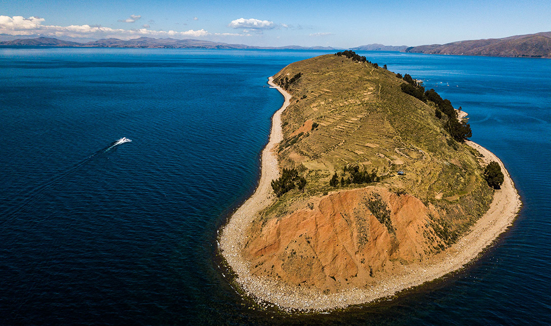
Другой остров, заслуживающий внимания, – Исла-дель-Соль. На нем постоянно проживает до 800 семей. Остров расположен в боливийской части озера. На нем присутствует около 180 руин, представляющих интерес для археологов и туристов.
К северу от Исла-дель-Соль есть остров Исла-де-ла-Луна. Он расположен в боливийских водах. В восточной его части находятся руины женского монастыря инков Мамакуна.
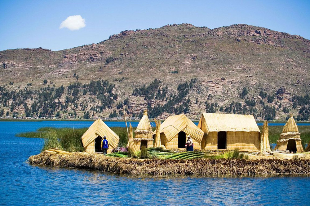
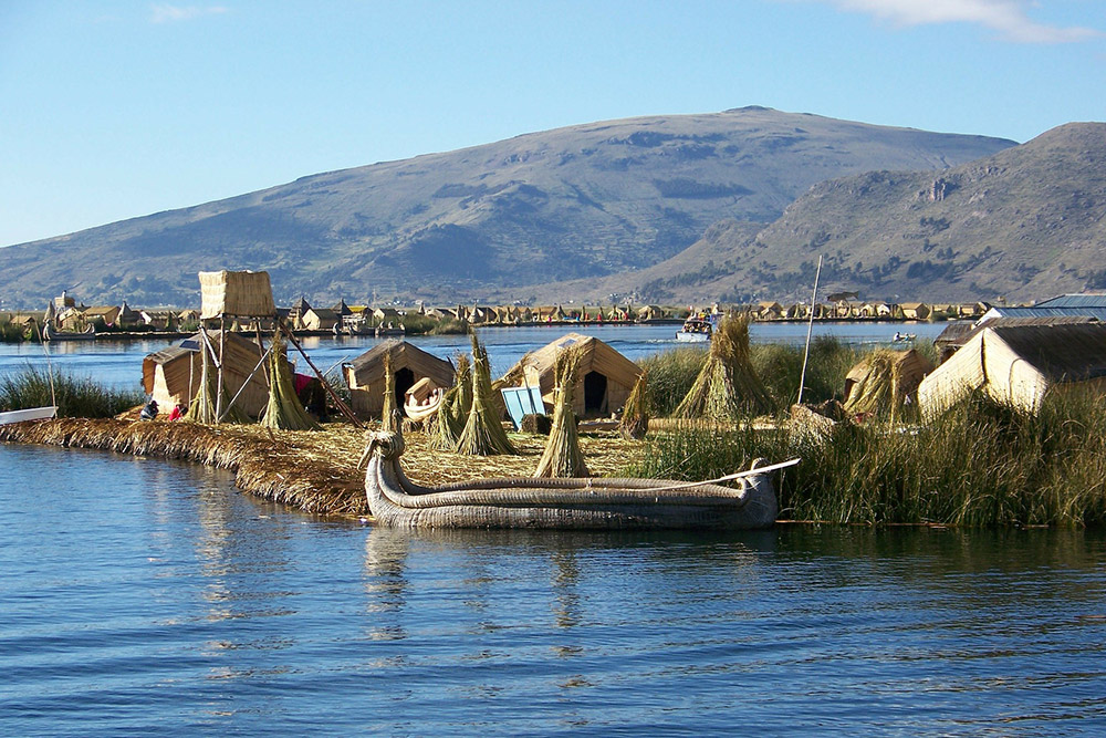
Кроме того, в озере присутствуют рукотворные «плавучие» острова, которые возведены народом урос. Они изготовлены из резаной тоторы, т.е. разновидности плавучей осоки.
Уросы постоянно добавляют сверху растительный строительный материал, чтобы обеспечить плавучесть островов. Согласно легенде эта народность пришла из бассейна Амазонки еще до географических открытий Колумба. Размер островов составляет примерно 15Х15 м. Они имеют характерный золотистый цвет.
Фауна озера Титикака
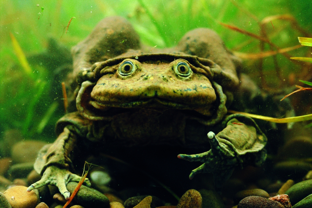
Титикака включено в список водно-болотных угодий, имеющих международное значение. В нем обитают 18 видов земноводных. Наибольший интерес представляет лягушка – титиканский свистун.
Она живет под камнями и редко выходит на поверхность. У нее небольшие легкие, поэтому ученые считают, что животное большую часть кислорода потребляет через кожу под водой.
В озере живет много видов рыб. Некоторые из них были заселены в водоем людьми. На берегах Титикака встречается около 60 разновидностей местных и мигрирующих птиц. Для орнитологов особый интерес представляют титиканские нелетающие поганки, являющиеся эндемиком этих мест.
Среди часто встречающихся птиц выделяются:
- бакланы;
- тонкоклювая каравайка;
- утки;
- андская ласточка;
- чибис;
- чайка;
- ибис;
- лысухи;
- камышевик;
- черный дрозд;
- цапли;
- чилийский фламинго;
- обыкновенная кваква и т.д.
В окрестностях озера встречается не так много млекопитающих. Наиболее распространены дикие морские свинки, вискаши, альпаки, ламы, андские скунсы, лисы и волки.
Ламы
Ламы, обитающие возле озера Титикака, являются одомашненными. Они достаточно крупные. Рост взрослого животного составляет примерно 1,3 м. Весят они до 200 кг. Ламы выносливы и хорошо переносят холод.
Они являются источником мяса и шерсти для местного населения. Кроме того, лам часто используют для перемещения грузов по холмистой местности.
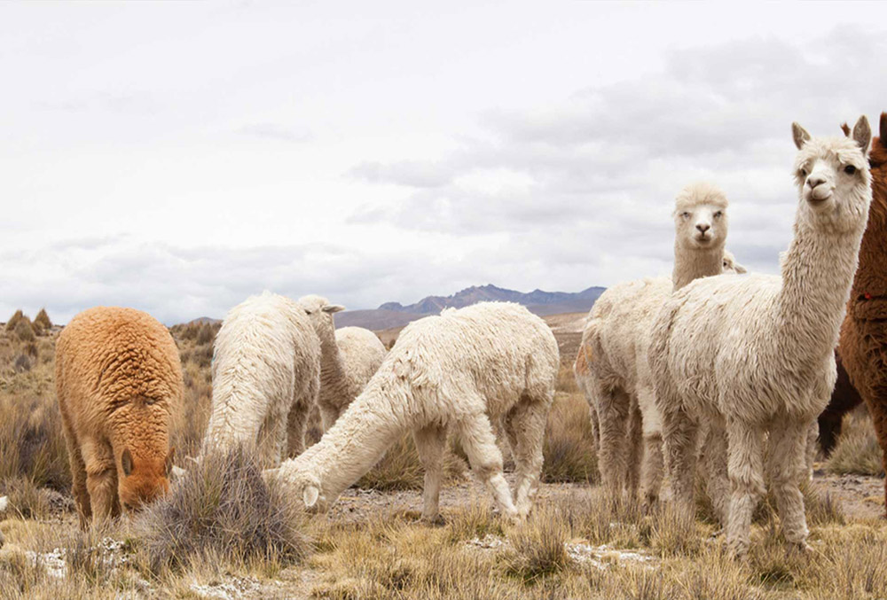
Альпаки
Альпаки являются близкими родственниками лам, т.к. произошли от одного дикого предка. Эти создания более низкорослые. Взрослые особи редко превышают 0,9 м в высоту. Вес животного составляет 90 кг. Альпаки дают более тонкую и качественную шерсть. Кроме того, их мясо характеризуется лучшим вкусом. Местные жители часто разводят этих животных.
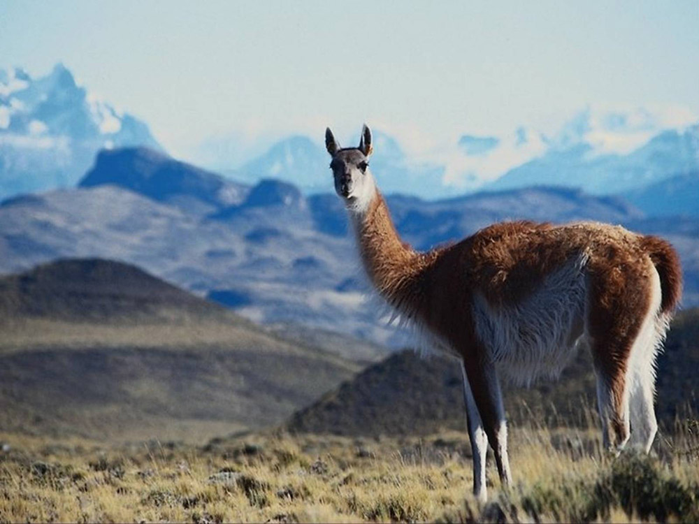
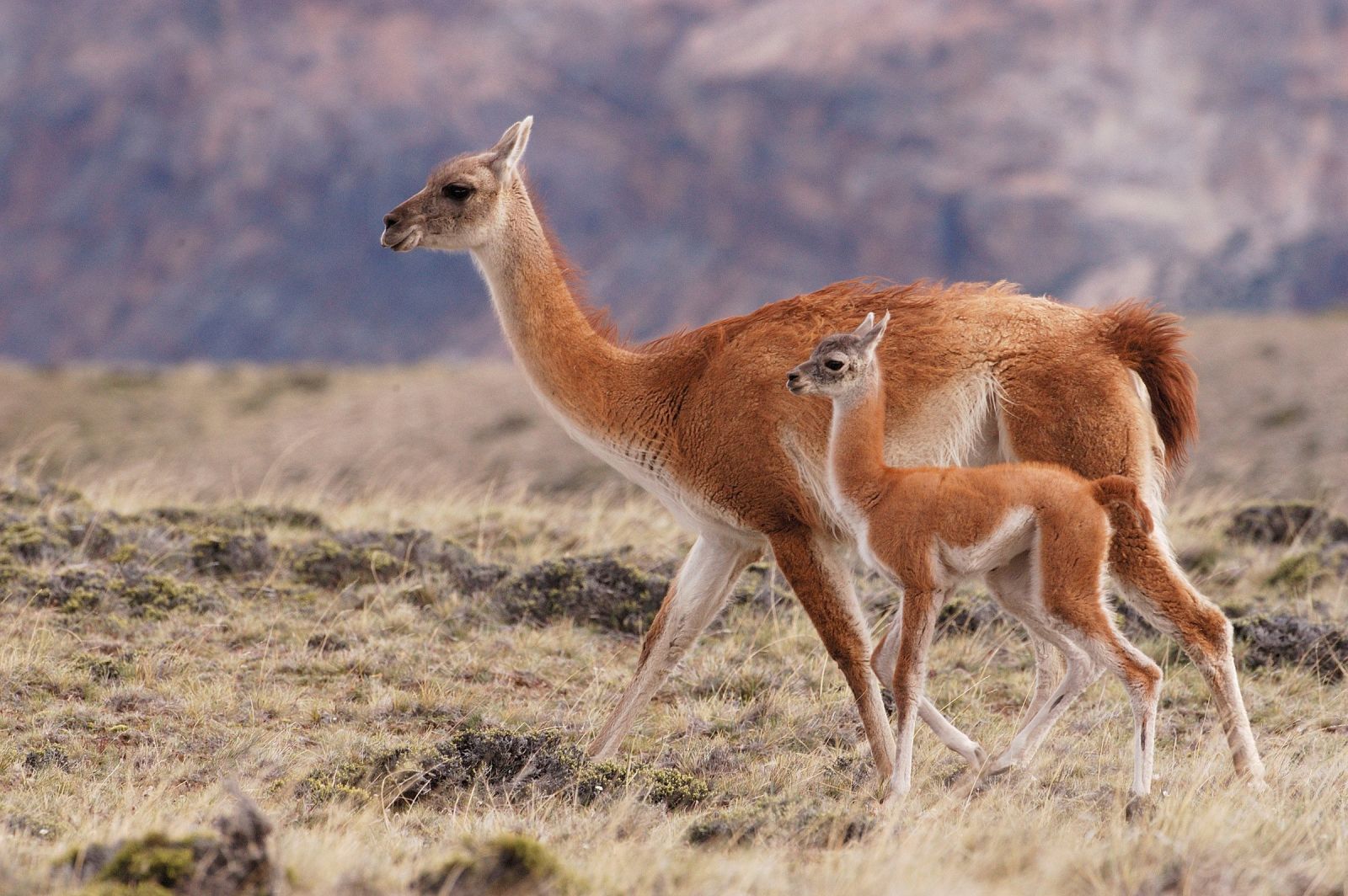
Викуньи
Викуньи – это дикие родственницы альпак и лам. Они адаптированы к горной местности, питаются скудной растительностью и переживают даже сильные холода.
В отличие от своих одомашненных родственниц, викуньи имеют небольшие уши, более густую шерсть рыжего цвета и острые зубы, благодаря которым обкусывают побеги даже с кустарников.
Средний рост животного – 150 см. Их популяция сокращается, т.к. они часто становятся жертвами браконьеров, добывающих мясо и шерсть этих представителей фауны.
Интересные факты про озеро
С озером Титикака связано немало интересных фактов.
Некоторые из них:
- Озеро считается наиболее высокогорным судоходным водоемом в мире. Корабли плавают по нему на протяжении всего года.
- В 2000 г. на дне Титикака были выявлены развалины храма, датирующегося 500–1000 г. н.э., т.е. временами до становления цивилизации инков.
- Самый возделываемый участок суши находится на этом озере. Здесь зерновые культуры выращивают на высоте 4700 м над уровнем моря.
- Весь боливийский флот, насчитывающий 173 небольших судна, пришвартованы на озере Титикака.
- Согласно одной из легенд, на дне водоема есть древний город, где инки прятали свои сокровища от конкистадоров.
Экскурсии по Титикака
Туризм на Титикака стремительно развивается, поэтому с каждым годом появляется все больше новых отелей, а также экскурсионных маршрутов. Сейчас можно посетить достопримечательности как в боливийской, так и в перуанской части озера.
Однодневные
На островах нет отелей, где могут с комфортом расположиться туристы, поэтому особой популярностью пользуются однодневные экскурсии. Гостям предоставляется возможность посещения достопримечательностей озера и его окрестностей с последующим возращением. Экскурсии проводят местные гиды.
Многодневные
Разработаны и многодневные туры. Они позволяют за короткий период осмотреть все достопримечательности озера. Посещение большинства из них предполагает остановки на островах с заселением в дома местных жителей или палаточные городки.
Во время многодневных экскурсий есть возможность посмотреть импровизированные представления и танцы коренных народов, которые проходят по вечерам для развлечения туриста.
Цены билетов на туры
Средняя цена на туры на озеро составляет от 1200 до 2500 долларов. Стоимость экскурсий колеблется от 10 до 500 долларов с человека.